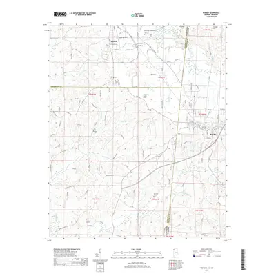
2018 Map of Red Bay
USGS Topo · Published 2018About this map
The Tennessee Valley Divide snakes through this borderland where Alabama and Mississippi meet, defining the drainage of the region's numerous creeks. In the east, the city of Red Bay serves as a local hub, featuring established landmarks such as Hillcrest Memorial Gardens and Red Bay Cem. The landscape is dotted with family-named cemeteries and rural congregations, including Burgess Cem and New Bethel Ch, which provide valuable touchpoints for genealogical research.
Find a feature on this map
106 named features on this map. Tap any name to fly to it.
Don’t see what you’re looking for? This feature index may not catch every label — zoom into the map to look around manually.
Map Details
Editions of this 2018 Red Bay Map
This is the sole edition of this map. No revisions or reprints were ever made.
Other maps of this area

1935 · Pleasant Site
USGS Topo · 1:24,000

1936 · Belmont
USGS Topo · 1:24,000

1936 · Red Bay
USGS Topo · 1:24,000

1936 · Vina
USGS Topo · 1:24,000

1936 · Halltown
USGS Topo · 1:24,000

1950 · Belmont
USGS Topo · 1:24,000

1950 · Vina
USGS Topo · 1:24,000
1950 · Halltown
USGS Topo · 1:24,000
1950 · Pleasant Site
USGS Topo · 1:24,000
1951 · Pleasant Site
USGS Topo · 1:24,000