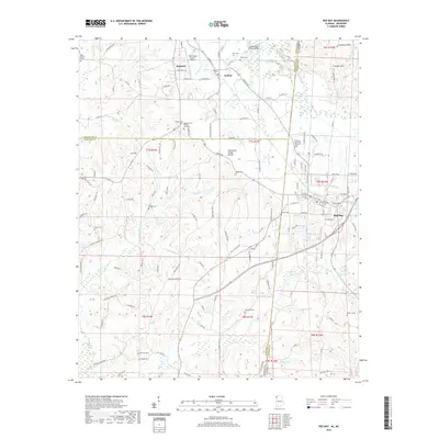
2020 Map of Red Bay
USGS Topo · Published 2020About this map
Red Bay serves as the focal point of this region, situated where the Alabama state line meets Mississippi across a landscape defined by the Tennessee Valley Divide. The drainage patterns are clearly delineated, with the Freedom Hills rising in the northeast while numerous creeks like Chubby Cr and its forks provide the primary relief to the west. This 2020 record of the borderlands highlights a significant number of family and community burial grounds, including the Burgess Cem African American and Hillcrest Memorial Gardens.
Find a feature on this map
154 named features on this map. Tap any name to fly to it.
Don’t see what you’re looking for? This feature index may not catch every label — zoom into the map to look around manually.
Map Details
Editions of this 2020 Red Bay Map
This is the sole edition of this map. No revisions or reprints were ever made.
Other maps of this area

1935 · Pleasant Site
USGS Topo · 1:24,000

1936 · Belmont
USGS Topo · 1:24,000

1936 · Red Bay
USGS Topo · 1:24,000

1936 · Vina
USGS Topo · 1:24,000

1936 · Halltown
USGS Topo · 1:24,000

1950 · Belmont
USGS Topo · 1:24,000

1950 · Vina
USGS Topo · 1:24,000
1950 · Halltown
USGS Topo · 1:24,000
1950 · Pleasant Site
USGS Topo · 1:24,000
1951 · Pleasant Site
USGS Topo · 1:24,000