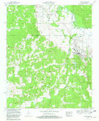
1981 Map of Red Bay
USGS Topo · Published 1982About this map
Belmont and Golden sit along the northern edge of this 1980s landscape, where the Illinois Central Gulf railroad serves as a primary transit corridor through the Divide. The town of Red Bay appears as a developed hub near the state line, featuring a High School, Hospital, and multiple municipal facilities. The surrounding countryside is defined by the winding paths of Bear Creek and Chubby Creek, punctuated by small local landmarks like the Drive-in Theater near Belmont and the Banner Community Center further south.
Find a feature on this map
61 named features on this map. Tap any name to fly to it.
Don’t see what you’re looking for? This feature index may not catch every label — zoom into the map to look around manually.
Map Details
Editions of this 1981 Red Bay Map
This is the sole edition of this map. No revisions or reprints were ever made.
Other maps of this area

1935 · Pleasant Site
USGS Topo · 1:24,000

1936 · Belmont
USGS Topo · 1:24,000

1936 · Red Bay
USGS Topo · 1:24,000

1936 · Vina
USGS Topo · 1:24,000

1936 · Halltown
USGS Topo · 1:24,000

1950 · Belmont
USGS Topo · 1:24,000

1950 · Vina
USGS Topo · 1:24,000
1950 · Halltown
USGS Topo · 1:24,000
1950 · Pleasant Site
USGS Topo · 1:24,000
1951 · Pleasant Site
USGS Topo · 1:24,000