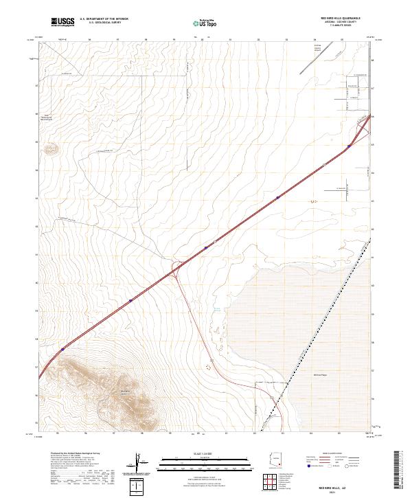
2021 Map of Red Bird Hills
USGS Topo · Published 2021About this map
Willcox Playa dominates the southeastern quadrant of this map, reflecting the arid basin-and-range topography characteristic of the region. The landscape transitions from the flat, dry lakebed toward the elevated terrain of the Red Bird Hills in the southwest. This area serves as a transit and aviation corridor, anchored by the Cochise County Airport in the north and the Indie Motorsports Ranch Airport to the west.
Find a feature on this map
28 named features on this map. Tap any name to fly to it.
Don’t see what you’re looking for? This feature index may not catch every label — zoom into the map to look around manually.
Map Details
Editions of this 2021 Red Bird Hills Map
This is the sole edition of this map. No revisions or reprints were ever made.
Other maps of this area

1922 · Willcox
USGS Topo · 1:125,000

1943 · Willcox
USGS Topo · 1:62,500

1943 · Cochise
USGS Topo · 1:62,500

1943 · Dragoon
USGS Topo · 1:62,500

1943 · Winchester Mts.
USGS Topo · 1:62,500

1945 · Winchester Mts.
USGS Topo · 1:62,500

1954 · Silver City
USGS Topo · 1:250,000

1956 · Tucson
USGS Topo · 1:250,000

1957 · Winchester Mts.
USGS Topo · 1:62,500

1958 · Silver City
USGS Topo · 1:250,000