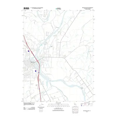
2012 Map of Red Bluff East
USGS Topo · Published 2012About this map
The Sacramento River carves a winding path through this portion of Tehama County, shaping a landscape defined by its riparian hydrology and agricultural infrastructure. In the heart of the sheet, the city of Red Bluff sits on the western bank, with its residential grid extending toward the Oak Hill Cem. The river's influence is seen in the complex network of sloughs and creeks, including Samson Slough and Paynes Cr Slough, which branch across the fertile bottomlands. To the north, the river narrows through Iron Canyon before reaching the prominent river loop at Big Bend.
Find a feature on this map
96 named features on this map. Tap any name to fly to it.
Don’t see what you’re looking for? This feature index may not catch every label — zoom into the map to look around manually.
Map Details
Editions of this 2012 Red Bluff East Map
This is the sole edition of this map. No revisions or reprints were ever made.
Other maps of this area

1890 · Red Bluff
USGS Topo · 1:250,000

1894 · Red Bluff
USGS Topo · 1:250,000

1905 · Tehama
USGS Topo · 1:62,500

1944 · Tuscan Buttes
USGS Topo · 1:62,500

1947 · Tuscan Buttes
USGS Topo · 1:62,500

1947 · Anderson
USGS Topo · 1:62,500

1948 · Anderson
USGS Topo · 1:62,500

1950 · Gerber
USGS Topo · 1:24,000

1951 · Gerber
USGS Topo · 1:24,000

1951 · Red Bluff East
USGS Topo · 1:24,000