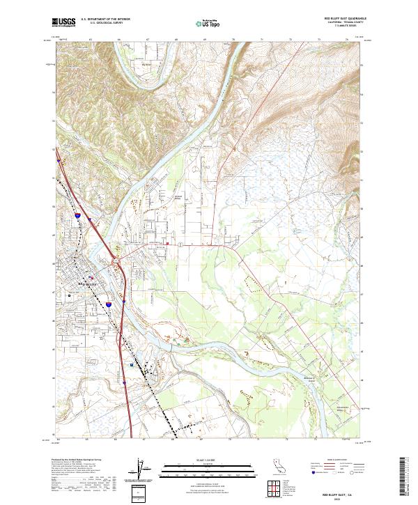
2022 Map of Red Bluff East
USGS Topo · Published 2022About this map
The Sacramento River anchors this study of Tehama County, cutting through the landscape just east of the city of Red Bluff. This 2022 survey details the extensive water management infrastructure vital to the region, including the Tehama-Colusa Canal and Corning Canal. The river's influence is evident in the complex network of sloughs and creeks, such as Samson Slough and Antelope Creek, which feed into the main channel near Blackberry Island. The southeastern portion is dedicated to conservation within the Sacramento River National Wildlife Refuge.
Find a feature on this map
164 named features on this map. Tap any name to fly to it.
Don’t see what you’re looking for? This feature index may not catch every label — zoom into the map to look around manually.
Map Details
Editions of this 2022 Red Bluff East Map
This is the sole edition of this map. No revisions or reprints were ever made.
Other maps of this area

1890 · Red Bluff
USGS Topo · 1:250,000

1894 · Red Bluff
USGS Topo · 1:250,000

1905 · Tehama
USGS Topo · 1:62,500

1944 · Tuscan Buttes
USGS Topo · 1:62,500

1947 · Tuscan Buttes
USGS Topo · 1:62,500

1947 · Anderson
USGS Topo · 1:62,500

1948 · Anderson
USGS Topo · 1:62,500

1950 · Gerber
USGS Topo · 1:24,000

1951 · Gerber
USGS Topo · 1:24,000

1951 · Red Bluff East
USGS Topo · 1:24,000