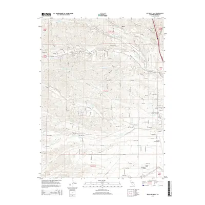
2015 Map of Red Bluff West
USGS Topo · Published 2015About this map
Red Bluff serves as the focal point for this survey of the northern Sacramento Valley, where the flat plains of the Central Valley begin to meet the undulating western foothills. The landscape is defined by a dense network of seasonal and perennial watercourses, including Dibble Creek, Reeds Creek, and Red Bank Creek, which carve distinct drainage patterns across the terrain. The map captures the western expansion of the town, transitioning from established street grids to more dispersed rural residential development along roads like Beegum Rd and Jellys Ferry Rd. Infrastructure essential to the region's mid-20th-century development is well-represented, notably the Red Bluff Municipal Airport and the centrally located Saint Marys Cemetery. To the north, the small settlement of Blunt sits near Blue Tent Cr, illustrating the sparse but persistent rural footprint in this part of Tehama County.
Find a feature on this map
130 named features on this map. Tap any name to fly to it.
Don’t see what you’re looking for? This feature index may not catch every label — zoom into the map to look around manually.
Map Details
Editions of this 2015 Red Bluff West Map
This is the sole edition of this map. No revisions or reprints were ever made.
Other maps of this area

1890 · Red Bluff
USGS Topo · 1:250,000

1894 · Red Bluff
USGS Topo · 1:250,000

1905 · Tehama
USGS Topo · 1:62,500

1944 · Tuscan Buttes
USGS Topo · 1:62,500

1947 · Tuscan Buttes
USGS Topo · 1:62,500

1947 · Anderson
USGS Topo · 1:62,500

1948 · Anderson
USGS Topo · 1:62,500

1950 · Gerber
USGS Topo · 1:24,000

1951 · Gerber
USGS Topo · 1:24,000

1951 · Red Bluff East
USGS Topo · 1:24,000