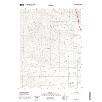
2018 Map of Red Bluff West
USGS Topo · Published 2018About this map
Red Bluff sits at the edge of the Sacramento Valley, serving as a vital point where the agricultural plains meet the rolling hills of Tehama County. The landscape is defined by a dense network of watercourses, including the westward reaches of Reeds Creek and Dibble Creek, which have shaped the settlement and ranching patterns of the area. On the western outskirts of the city, the Red Bluff Municipal Airport and the Saint Marys Cem mark the transition from urban development to more rural terrain. Further north, the small settlement of Blunt is located near Blue Tent Creek. The map provides significant detail for genealogists and local historians, showing specific road names and an Air Strip that reflect the region's mid-century aviation and transit history.
Find a feature on this map
146 named features on this map. Tap any name to fly to it.
Don’t see what you’re looking for? This feature index may not catch every label — zoom into the map to look around manually.
Map Details
Editions of this 2018 Red Bluff West Map
This is the sole edition of this map. No revisions or reprints were ever made.
Other maps of this area

1890 · Red Bluff
USGS Topo · 1:250,000

1894 · Red Bluff
USGS Topo · 1:250,000

1905 · Tehama
USGS Topo · 1:62,500

1944 · Tuscan Buttes
USGS Topo · 1:62,500

1947 · Tuscan Buttes
USGS Topo · 1:62,500

1947 · Anderson
USGS Topo · 1:62,500

1948 · Anderson
USGS Topo · 1:62,500

1950 · Gerber
USGS Topo · 1:24,000

1951 · Gerber
USGS Topo · 1:24,000

1951 · Red Bluff East
USGS Topo · 1:24,000