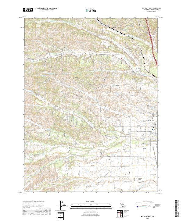
2022 Map of Red Bluff West
USGS Topo · Published 2022About this map
Red Bluff serves as the focal point of this 2022 survey, showcasing the western residential and civic portions of the city including the Tehama County Courthouse. The landscape transitions from the developed grid of the city to the complex drainage systems of the Sacramento Valley. Numerous seasonal and perennial waterways, such as Reeds Cr, Blue Tent Creek, and North Fork Dibble Creek, carve through the terrain as they flow eastward. To the north, the small settlement of Blunt is identified among the residential developments and hills. Family and local history can be traced through sites like Saint Marys Cem and the naming of rural routes. The map also captures infrastructure critical to the region's transport, most notably the Red Bluff Municipal Airport, which occupies a large footprint on the valley floor south of the main town center.
Find a feature on this map
150 named features on this map. Tap any name to fly to it.
Don’t see what you’re looking for? This feature index may not catch every label — zoom into the map to look around manually.
Map Details
Editions of this 2022 Red Bluff West Map
This is the sole edition of this map. No revisions or reprints were ever made.
Other maps of this area

1890 · Red Bluff
USGS Topo · 1:250,000

1894 · Red Bluff
USGS Topo · 1:250,000

1905 · Tehama
USGS Topo · 1:62,500

1944 · Tuscan Buttes
USGS Topo · 1:62,500

1947 · Tuscan Buttes
USGS Topo · 1:62,500

1947 · Anderson
USGS Topo · 1:62,500

1948 · Anderson
USGS Topo · 1:62,500

1950 · Gerber
USGS Topo · 1:24,000

1951 · Gerber
USGS Topo · 1:24,000

1951 · Red Bluff East
USGS Topo · 1:24,000