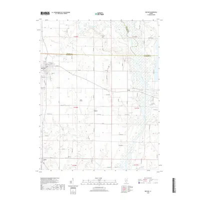
2018 Map of Red Bud
USGS Topo · Published 2018About this map
Red Bud and the smaller village of Ruma serve as the primary anchors of this southwestern Illinois landscape, where the confluence of the Kaskaskia River and Baldwin Lake defines the eastern boundary. The map reveals a transition from the structured street grid of Red Bud, with its historic thoroughfares like E Market St and Mill St, to the wide agricultural expanses of Horse Prairie and Prairie. For family historians, several small burial sites are preserved across the rural countryside, including Brickey Cem, Ralls Cem, and Saint John Cem. The terrain is shaped by the wandering paths of Horse Creek and Richland Creek, which flow through the undulating land surrounding Rock Hill. This modern survey documents the contemporary road network, including Elm Shade Rd and Ralls Ridge Rd, alongside legacy water features like Long Lake and Schaffner Lake.
Find a feature on this map
74 named features on this map. Tap any name to fly to it.
Don’t see what you’re looking for? This feature index may not catch every label — zoom into the map to look around manually.
Map Details
Editions of this 2018 Red Bud Map
This is the sole edition of this map. No revisions or reprints were ever made.
Other maps of this area

1910 · Waterloo
USGS Topo · 1:62,500

1912 · New Athens
USGS Topo · 1:62,500

1912 · Baldwin
USGS Topo · 1:62,500

1913 · Waterloo
USGS Topo · 1:62,500

1914 · Baldwin
USGS Topo · 1:62,500

1915 · Renault
USGS Topo · 1:62,500

1940 · Renault
USGS Topo · 1:62,500

1942 · Baldwin
USGS Topo · 1:62,500

1949 · Saint Louis
USGS Topo · 1:250,000

1954 · New Athens West
USGS Topo · 1:24,000