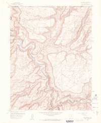
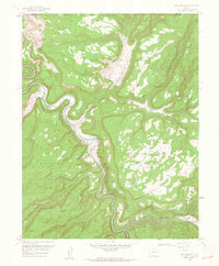
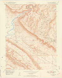
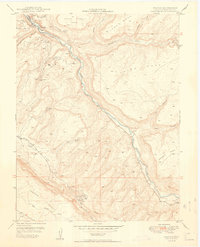
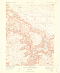
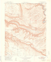
1960 Map of Red Canyon
USGS Topo · Published 1961About this map
The confluence of the Dolores River and the San Miguel River anchors this 1960 survey of a mining-heavy landscape in western Colorado. The map reveals an intensive era of mineral extraction along the canyon walls and high mesas, particularly evident near Club Ranch and throughout Martin Mesa. Notable operations like the Shamrock Mine, Bluebird Mine, and the Dakota Mine are situated among the intricate drainage networks of Red Canyon and Roc Creek. The presence of several Placer Mine sites along the riverbanks and a remote Airstrip (Abandoned) on Atkinson Mesa indicates the logistical challenges of this industrial frontier. Between the high plateaus of Blue Mesa and Carpenter Flats, the terrain is marked by dozens of small claims, including the Little Dick Mine and Club Sandwich Mine, showing the density of mid-century exploration.
Find a feature on this map
51 named features on this map. Tap any name to fly to it.
Don’t see what you’re looking for? This feature index may not catch every label — zoom into the map to look around manually.
Map Details
Editions of this 1960 Red Canyon Map
3 editions found

Other maps of this area

1916 · Paradox Valley
USGS Topo · 1:125,000

1922 · Paradox Valley
USGS Topo · 1:125,000

1948 · Roc Creek
USGS Topo · 1:24,000

1948 · Uravan
USGS Topo · 1:24,000

1948 · Paradox
USGS Topo · 1:24,000
1949 · Davis Mesa
USGS Topo · 1:24,000
1949 · Uravan
USGS Topo · 1:24,000
1949 · Paradox
USGS Topo · 1:24,000
1949 · Roc Creek
USGS Topo · 1:24,000

1949 · Juanita Arch
USGS Topo · 1:24,000