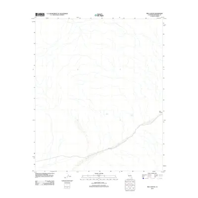
2012 Map of Red Canyon
USGS Topo · Published 2012About this map
Bradshaw Rd follows a winding path across this arid landscape in eastern Riverside County, tracing a route that connects the low-lying washes with the elevation of the Orocopia Mountains. This 2012 survey illustrates the remote desert character of the region, where water sources are vital landmarks for travelers and locals alike. Points such as Gucci Spring and Canyon Spring are noted along the drainage systems that feed into Salt Cr. The namesake Red Canyon cuts through the southeastern portion of the map, revealing the intricate drainage patterns and geological formations that define this part of the Colorado Desert. The lack of modern development highlight's the area's role as a rugged corridor through the southern California wilderness.
Find a feature on this map
5 named features on this map. Tap any name to fly to it.
Don’t see what you’re looking for? This feature index may not catch every label — zoom into the map to look around manually.
Map Details
Editions of this 2012 Red Canyon Map
This is the sole edition of this map. No revisions or reprints were ever made.
Other maps of this area

1940 · Frink
USGS Topo · 1:62,500

1940 · Cottonwood Spring
USGS Topo · 1:62,500

1940 · Canyon Spring
USGS Topo · 1:62,500

1940 · Durmid
USGS Topo · 1:62,500

1943 · Canyon Spring
USGS Topo · 1:62,500

1944 · Cottonwood Spring
USGS Topo · 1:62,500

1944 · Durmid
USGS Topo · 1:62,500

1944 · Frink
USGS Topo · 1:62,500

1954 · Salton Sea
USGS Topo · 1:250,000

1955 · Salton Sea
USGS Topo · 1:250,000