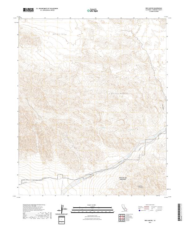
2021 Map of Red Canyon
USGS Topo · Published 2021About this map
The Orocopia Mountains dominate this 2021 landscape, showing the arid drainage patterns and structural geology of southeastern California. This terrain is defined by the steep relief of the Red Canyon and the broad reaches of the Maniobra Valley to the north. Historic transportation routes are a primary focal point, as Bradshaw Rd and the Bradshaw Trl trace the low-lying southern corridor through the desert, providing a modern look at a legendary gold-rush era passage. Isolated water sources, critical for desert travel and survival, are identified at Gucci Spring and Canyon Spring, while the seasonal path of Salt Cr cuts through the southeastern corner. To the south, the map captures the northern fringe of the Chocolate Mountains, illustrating the complex topography where these ranges meet.
Find a feature on this map
16 named features on this map. Tap any name to fly to it.
Don’t see what you’re looking for? This feature index may not catch every label — zoom into the map to look around manually.
Map Details
Editions of this 2021 Red Canyon Map
This is the sole edition of this map. No revisions or reprints were ever made.
Other maps of this area

1940 · Frink
USGS Topo · 1:62,500

1940 · Cottonwood Spring
USGS Topo · 1:62,500

1940 · Canyon Spring
USGS Topo · 1:62,500

1940 · Durmid
USGS Topo · 1:62,500

1943 · Canyon Spring
USGS Topo · 1:62,500

1944 · Cottonwood Spring
USGS Topo · 1:62,500

1944 · Durmid
USGS Topo · 1:62,500

1944 · Frink
USGS Topo · 1:62,500

1954 · Salton Sea
USGS Topo · 1:250,000

1955 · Salton Sea
USGS Topo · 1:250,000