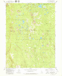
1979 Map of Red Cinder
USGS Topo · Published 1979About this map
Caribou Wilderness and Lassen National Forest define this high-altitude landscape in the late 1970s, where volcanic features and alpine lakes dominate the terrain. Significant elevations like North Caribou, South Caribou, and Black Cinder Rock rise above a dense network of water bodies, including Emerald Lake, Shotoverin Lake, and Evelyn Lake. The map records traces of earlier human presence at the Heckle Ranch (Site) near Bailey Creek, providing a specific point of interest for researchers of local ranching history.
Find a feature on this map
49 named features on this map. Tap any name to fly to it.
Don’t see what you’re looking for? This feature index may not catch every label — zoom into the map to look around manually.
Map Details
Editions of this 1979 Red Cinder Map
2 editions found
Other maps of this area

1886 · Lassen Peak
USGS Topo · 1:250,000

1892 · Lassen Peak
USGS Topo · 1:250,000

1894 · Lassen Peak
USGS Topo · 1:250,000

1939 · Halls Flat
USGS Topo · 1:125,000

1955 · Westwood
USGS Topo · 1:250,000

1956 · Mt. Harkness
USGS Topo · 1:62,500

1956 · Chester
USGS Topo · 1:62,500

1956 · Harvey Mtn
USGS Topo · 1:62,500

1957 · Prospect Peak
USGS Topo · 1:62,500

1958 · Westwood
USGS Topo · 1:250,000