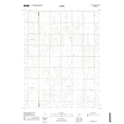
2017 Map of Red Cloud NW
USGS Topo · Published 2017About this map
The county line between Franklin and Webster Counties divides this agricultural landscape, where the headwaters of numerous creeks carve a complex drainage pattern across the Nebraska plains. For genealogists and local historians, the sheet is anchored by several rural burial grounds, including Catherton Cem in the northeast and Zion Cem along the county boundary. These cemeteries, alongside New Virginia Cem and Pleasant Prairie Cem, reflect the legacy of early prairie settlements and the families who established farms in this region of the Republican River watershed.
Find a feature on this map
38 named features on this map. Tap any name to fly to it.
Don’t see what you’re looking for? This feature index may not catch every label — zoom into the map to look around manually.
Map Details
Editions of this 2017 Red Cloud NW Map
This is the sole edition of this map. No revisions or reprints were ever made.
Other maps of this area

1897 · Red Cloud
USGS Topo · 1:125,000

1940 · Red Cloud
USGS Topo · 1:62,500

1942 · Red Cloud
USGS Topo · 1:62,500

1955 · Grand Island
USGS Topo · 1:250,000

1957 · Grand Island
USGS Topo · 1:250,000

1958 · Grand Island
USGS Topo · 1:250,000

1969 · Upland SE
USGS Topo · 1:24,000
1969 · Campbell
USGS Topo · 1:24,000
1969 · Bladen
USGS Topo · 1:24,000
1974 · Riverton
USGS Topo · 1:24,000