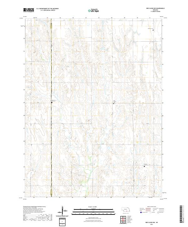
2021 Map of Red Cloud NW
USGS Topo · Published 2021About this map
Rural Webster and Franklin Counties are defined by the intricate branching of W Fork Farmers Cr, Farmers Cr, and E Fork Farmers Cr as they carve through the Nebraska plains. This landscape is shaped by agricultural section lines and a network of named roads, including RD T and RD 400, which connect the isolated farmsteads and cemeteries of this prairie region. Notable water features like Bartell Reservoir and Spring Cr provide essential points of interest in a terrain dominated by steady elevation changes and drainage patterns.
Find a feature on this map
36 named features on this map. Tap any name to fly to it.
Don’t see what you’re looking for? This feature index may not catch every label — zoom into the map to look around manually.
Map Details
Editions of this 2021 Red Cloud NW Map
This is the sole edition of this map. No revisions or reprints were ever made.
Other maps of this area

1897 · Red Cloud
USGS Topo · 1:125,000

1940 · Red Cloud
USGS Topo · 1:62,500

1942 · Red Cloud
USGS Topo · 1:62,500

1955 · Grand Island
USGS Topo · 1:250,000

1957 · Grand Island
USGS Topo · 1:250,000

1958 · Grand Island
USGS Topo · 1:250,000

1969 · Upland SE
USGS Topo · 1:24,000
1969 · Campbell
USGS Topo · 1:24,000
1969 · Bladen
USGS Topo · 1:24,000
1974 · Riverton
USGS Topo · 1:24,000