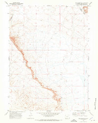
1970 Map of Red Desert SE
USGS Topo · Published 1973About this map
Continental Divide winds through this high-altitude landscape of the Great Divide Basin, captured in a 1970 field check by the Geological Survey. The prominent escarpment of Wells Bluff Delaney Rim dominates the western half of the map, revealing a stark geological transition where the land drops away from the plateau. This high desert terrain is punctuated by industry and early settlement traces, including several drill holes and a Corral that suggest the intersection of energy exploration and traditional ranching. To the east, the basin floor features the Red Lakes and the rising elevations of Big Hill and the Wamsutter Rim. The lack of permanent watercourses underscores the arid character of this watershed, where the topography itself directs the flow of seasonal runoff across the Sweetwater County plains.
Find a feature on this map
7 named features on this map. Tap any name to fly to it.
Don’t see what you’re looking for? This feature index may not catch every label — zoom into the map to look around manually.
Map Details
Editions of this 1970 Red Desert SE Map
This is the sole edition of this map. No revisions or reprints were ever made.
Other maps of this area

1954 · Rawlins
USGS Topo · 1:250,000

1954 · Rock Springs
USGS Topo · 1:250,000

1958 · Rawlins
USGS Topo · 1:250,000

1958 · Rock Springs
USGS Topo · 1:250,000

1962 · Rawlins
USGS Topo · 1:250,000

1962 · Rock Springs
USGS Topo · 1:250,000

1966 · Wamsutter
USGS Topo · 1:24,000

1966 · Eightmile Lake
USGS Topo · 1:24,000

1967 · Rawlins
USGS Topo · 1:250,000

1970 · Red Desert SW
USGS Topo · 1:24,000