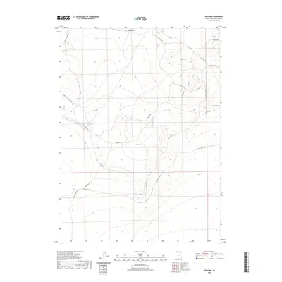
2020 Map of Red Dome
USGS Topo · Published 2020About this map
Red Dome rises above the arid basin floor of western Box Elder County, serving as a prominent landmark in a landscape defined by historic transit corridors. The transit history of the Great Basin is etched into the terrain here, where the Emigrant Trail Rd skirts the northern hills while the Old Railroad Grade Rd cuts a straight path across the southern flats. This intersection of nineteenth-century wagon routes and early rail infrastructure illustrates the region's role as a vital passage through the desert. To the northwest, Pugsley Reservoir provides a rare water source for the surrounding range, supporting the grazing lands that extend toward Airplane Hill and the Horse Hills. The network of local routes, including Terrace Mountain Rd and Pugsley Reservoir Rd, connects these isolated geographical features across the wide expanse of Matlin Basin.
Find a feature on this map
17 named features on this map. Tap any name to fly to it.
Don’t see what you’re looking for? This feature index may not catch every label — zoom into the map to look around manually.
Map Details
Editions of this 2020 Red Dome Map
This is the sole edition of this map. No revisions or reprints were ever made.
Other maps of this area

1954 · Brigham City
USGS Topo · 1:250,000

1958 · Brigham City
USGS Topo · 1:250,000

1962 · Brigham City
USGS Topo · 1:250,000

1971 · Prohibition Spring
USGS Topo · 1:24,000

1971 · Red Dome
USGS Topo · 1:24,000

1971 · Matlin
USGS Topo · 1:24,000
1971 · Runswick Wash
USGS Topo · 1:24,000

1971 · Warm Spring Hills
USGS Topo · 1:24,000
1971 · Russian Knoll
USGS Topo · 1:24,000

1983 · Terrace Mountain West
USGS Topo · 1:24,000