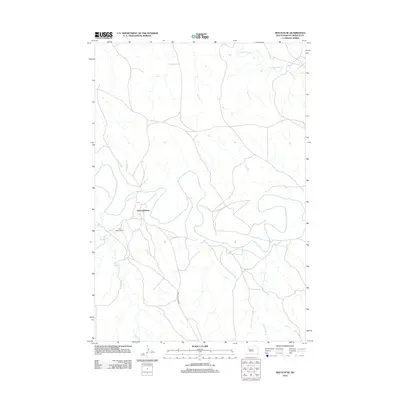
2012 Map of Red Elm NE
USGS Topo · Published 2012About this map
Iron Lightning sits at a crossroads in the western portion of this Dakota prairie landscape, situated near the winding course of the Moreau River. This 2012 survey illustrates the sparse, rural character of Ziebach County, where the settlement pattern is closely tied to the available water sources and local transit routes. The presence of the Iron Lightning Cem near Knife Cr provides a point of reference for those researching local family history or the development of this community. A network of light-duty roads and tracks, including the primary Iron Lightning Rd, connects the scattered homesteads and provides access across the northern plains. The terrain is defined by its drainages, with Thunder Butte Cr and Cottonwood Cr carving paths through the open land, reflecting the traditional ranching and agricultural footprint of the region.
Find a feature on this map
7 named features on this map. Tap any name to fly to it.
Don’t see what you’re looking for? This feature index may not catch every label — zoom into the map to look around manually.
Map Details
Editions of this 2012 Red Elm NE Map
This is the sole edition of this map. No revisions or reprints were ever made.
Other maps of this area

1951 · Redelm NE
USGS Topo · 1:24,000

1951 · Redelm NW
USGS Topo · 1:24,000

1951 · Thunder Butte
USGS Topo · 1:24,000

1953 · McIntosh
USGS Topo · 1:250,000

1958 · McIntosh
USGS Topo · 1:250,000

1979 · Dupree
USGS Topo · 1:25,000

1982 · Glad Valley SW
USGS Topo · 1:24,000

1982 · Irish Creek SW
USGS Topo · 1:24,000
1982 · Red Elm
USGS Topo · 1:24,000

1982 · Glad Valley SE
USGS Topo · 1:24,000