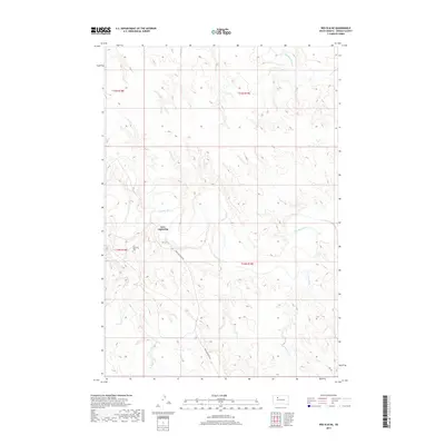
2017 Map of Red Elm NE
USGS Topo · Published 2017About this map
The Moreau River carves a serpentine path through this section of Ziebach County, defining a landscape shaped by significant drainage systems. The small community of Iron Lightning is the primary settlement focus, situated near the riverbanks where Iron Lightning Rd provides the principal overland access. This area reflects the rural character of the Cheyenne River Indian Reservation, where life is historically centered around these vital watercourses. Genealogists and local historians can locate the Iron Lightning Cem nearby, a key landmark for tracing family heritage in the region. The map also details several tributaries that feed into the main river valley, including Thunder Butte Cr, Cottonwood Cr, and Knife Cr, which illustrate the complex hydrology of these plains.
Find a feature on this map
12 named features on this map. Tap any name to fly to it.
Don’t see what you’re looking for? This feature index may not catch every label — zoom into the map to look around manually.
Map Details
Editions of this 2017 Red Elm NE Map
This is the sole edition of this map. No revisions or reprints were ever made.
Other maps of this area

1951 · Redelm NE
USGS Topo · 1:24,000

1951 · Redelm NW
USGS Topo · 1:24,000

1951 · Thunder Butte
USGS Topo · 1:24,000

1953 · McIntosh
USGS Topo · 1:250,000

1958 · McIntosh
USGS Topo · 1:250,000

1979 · Dupree
USGS Topo · 1:25,000

1982 · Glad Valley SW
USGS Topo · 1:24,000

1982 · Irish Creek SW
USGS Topo · 1:24,000
1982 · Red Elm
USGS Topo · 1:24,000

1982 · Glad Valley SE
USGS Topo · 1:24,000