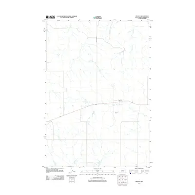
2012 Map of Red Elm
USGS Topo · Published 2012About this map
Red Elm and its surrounding prairie landscape in Ziebach County are defined by a network of drainage creeks and small earthen dams. This central South Dakota terrain is deeply etched by Elm Cr, which flows past the settlement and the nearby Red Elm Cem, a vital site for local genealogical research. Water management is a central theme of the landscape, seen in the presence of Sandoz Dam and Sargent Dam, which support cattle ranching and agricultural life in this arid region. The drainage patterns of Knife Cr, Cottonwood Cr, and Rattlesnake Cr converge throughout the quadrangle, illustrating the natural geography that dictates the placement of ranch roads and the few established homesteads. One of the more distinct water features is the Lake of the Woods, providing a rare larger body of water amidst the winding creek beds.
Find a feature on this map
10 named features on this map. Tap any name to fly to it.
Don’t see what you’re looking for? This feature index may not catch every label — zoom into the map to look around manually.
Map Details
Editions of this 2012 Red Elm Map
This is the sole edition of this map. No revisions or reprints were ever made.
Other maps of this area

1951 · Redelm NE
USGS Topo · 1:24,000

1951 · Redelm NW
USGS Topo · 1:24,000

1951 · Thunder Butte
USGS Topo · 1:24,000

1953 · McIntosh
USGS Topo · 1:250,000

1954 · Pierre
USGS Topo · 1:250,000

1958 · Pierre
USGS Topo · 1:250,000

1958 · McIntosh
USGS Topo · 1:250,000

1979 · Dupree
USGS Topo · 1:25,000

1982 · Bull Creek 2 NE
USGS Topo · 1:24,000

1982 · Bessie Butte
USGS Topo · 1:24,000