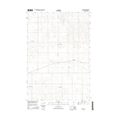
2015 Map of Red Elm
USGS Topo · Published 2015About this map
Red Elm and its surrounding prairie landscape define this portion of Ziebach County, where a network of seasonal creeks and constructed reservoirs support the region's agricultural life. The map details the small settlement of Red Elm located along the secondary highway, with the nearby Red Elm Cem serving as a local genealogical landmark. The drainage system is dominated by the winding paths of Elm Cr, Cottonwood Cr, and Knife Cr, which feed into various water management features. Lake of the Woods and individual impoundments like Sandoz Dam and Sargent Dam highlight the importance of water storage in this expansive Western South Dakota terrain. Section lines and established routes like Iron Lightning Rd provide a clear structure to the rural township grid, illustrating the persistent land use patterns of the Great Plains.
Find a feature on this map
14 named features on this map. Tap any name to fly to it.
Don’t see what you’re looking for? This feature index may not catch every label — zoom into the map to look around manually.
Map Details
Editions of this 2015 Red Elm Map
This is the sole edition of this map. No revisions or reprints were ever made.
Other maps of this area

1951 · Redelm NE
USGS Topo · 1:24,000

1951 · Redelm NW
USGS Topo · 1:24,000

1951 · Thunder Butte
USGS Topo · 1:24,000

1953 · McIntosh
USGS Topo · 1:250,000

1954 · Pierre
USGS Topo · 1:250,000

1958 · Pierre
USGS Topo · 1:250,000

1958 · McIntosh
USGS Topo · 1:250,000

1979 · Dupree
USGS Topo · 1:25,000

1982 · Bull Creek 2 NE
USGS Topo · 1:24,000

1982 · Bessie Butte
USGS Topo · 1:24,000