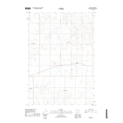
2017 Map of Red Elm
USGS Topo · Published 2017About this map
Red Elm and its surrounding plains in Ziebach County are defined by a network of drainage creeks and small earthen dams. This ranching landscape is carved by the winding paths of Knife Cr and Cottonwood Cr, which feed into the larger Elm Cr system. To the west, Rattlesnake Cr cuts through the prairie, while human-made landmarks like Sandoz Dam and Sargent Dam manage the area's scarce water resources. The small settlement of Red Elm serves as the local anchor, with the Red Elm Cem located just to the southwest. The geography is tied together by Iron Lightning Rd, which runs north-south through the center of the sheet, providing access to the expansive open spaces of the t13n r19e and t12n r19e townships.
Find a feature on this map
15 named features on this map. Tap any name to fly to it.
Don’t see what you’re looking for? This feature index may not catch every label — zoom into the map to look around manually.
Map Details
Editions of this 2017 Red Elm Map
This is the sole edition of this map. No revisions or reprints were ever made.
Other maps of this area

1951 · Redelm NE
USGS Topo · 1:24,000

1951 · Redelm NW
USGS Topo · 1:24,000

1951 · Thunder Butte
USGS Topo · 1:24,000

1953 · McIntosh
USGS Topo · 1:250,000

1954 · Pierre
USGS Topo · 1:250,000

1958 · Pierre
USGS Topo · 1:250,000

1958 · McIntosh
USGS Topo · 1:250,000

1979 · Dupree
USGS Topo · 1:25,000

1982 · Bull Creek 2 NE
USGS Topo · 1:24,000

1982 · Bessie Butte
USGS Topo · 1:24,000