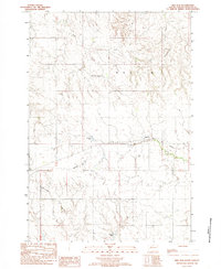
1982 Map of Red Elm
USGS Topo · Published 1983About this map
Red Elm and its surrounding prairie landscape are depicted in this early 1980s provisional study of Ziebach County. The map provides a detailed view of the regional water management system and natural drainage, featuring several small reservoirs like Lake of the Woods and man-made structures including Sandoz Dam and Sargent Dam. These water sources are vital components of the rural economy, supporting the cattle ranching and farming operations scattered across the plains.
Find a feature on this map
13 named features on this map. Tap any name to fly to it.
Don’t see what you’re looking for? This feature index may not catch every label — zoom into the map to look around manually.
Map Details
Editions of this 1982 Red Elm Map
This is the sole edition of this map. No revisions or reprints were ever made.
Other maps of this area

1951 · Redelm NE
USGS Topo · 1:24,000

1951 · Redelm NW
USGS Topo · 1:24,000

1951 · Thunder Butte
USGS Topo · 1:24,000

1953 · McIntosh
USGS Topo · 1:250,000

1954 · Pierre
USGS Topo · 1:250,000

1958 · Pierre
USGS Topo · 1:250,000

1958 · McIntosh
USGS Topo · 1:250,000

1979 · Dupree
USGS Topo · 1:25,000

1982 · Bull Creek 2 NE
USGS Topo · 1:24,000

1982 · Bessie Butte
USGS Topo · 1:24,000