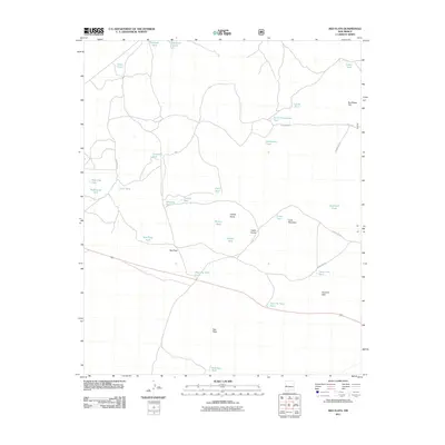
2011 Map of Red Flats
USGS Topo · Published 2011About this map
Lone Mountain and Red Peak rise above an arid landscape defined by its critical water management features and high-desert terrain. The area is marked by a vast network of catchment basins and reservoirs essential for ranching and livestock, including family-named landmarks like McWhorter Tank, Glasscock Tank, and Holden Tank. The southern portion of the quadrangle includes the Airplane Hills and the eponymous Red Flats, indicating a broad, open topography interrupted by distinctive geological formations such as Capital Dome and Castle Dome. The infrastructure is primarily composed of primitive forest roads, such as Forest Road 2 and Forest Road 312, which connect these remote water sources. This 2011 survey reflects the enduring character of Catron County's high country, where named tanks like West Pie Town Tank and East Pie Town Tank provide vital nodes for local navigation and land use.
Find a feature on this map
36 named features on this map. Tap any name to fly to it.
Don’t see what you’re looking for? This feature index may not catch every label — zoom into the map to look around manually.
Map Details
Editions of this 2011 Red Flats Map
This is the sole edition of this map. No revisions or reprints were ever made.
Other maps of this area

1954 · Saint Johns
USGS Topo · 1:250,000

1954 · Socorro
USGS Topo · 1:250,000

1957 · Saint Johns
USGS Topo · 1:250,000

1958 · Socorro
USGS Topo · 1:250,000

1958 · Saint Johns
USGS Topo · 1:250,000

1962 · Socorro
USGS Topo · 1:250,000

1962 · Saint Johns
USGS Topo · 1:250,000

1964 · Third Canyon
USGS Topo · 1:24,000
1964 · Madre Mountain
USGS Topo · 1:24,000

1964 · Crosby Springs
USGS Topo · 1:24,000