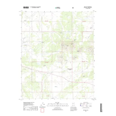
2020 Map of Red Flats
USGS Topo · Published 2020About this map
The Continental Divide winds through this high-elevation landscape of western Catron County, defining a territory marked by prominent volcanic and geologic formations. Within the Cibola National Forest, the Sawtooth Mountains dominate the central terrain, flanked by distinctive landmarks like Lone Mtn, Capital Dome, and Castle Dome. The land use is characterized by an extensive system of water management features, including numerous stock tanks such as McWhorter Tank and West Pie Town Tank, which support ranching across the open expanses of Sunflower Flat and the Red Flats. This 2020 survey illustrates the remote character of the New Mexico high country, where the intersection of public forest lands and private holdings is traced by a network of forest roads including Forest Rd 312 and Forest Rd 316.
Find a feature on this map
53 named features on this map. Tap any name to fly to it.
Don’t see what you’re looking for? This feature index may not catch every label — zoom into the map to look around manually.
Map Details
Editions of this 2020 Red Flats Map
This is the sole edition of this map. No revisions or reprints were ever made.
Other maps of this area

1954 · Saint Johns
USGS Topo · 1:250,000

1954 · Socorro
USGS Topo · 1:250,000

1957 · Saint Johns
USGS Topo · 1:250,000

1958 · Socorro
USGS Topo · 1:250,000

1958 · Saint Johns
USGS Topo · 1:250,000

1962 · Socorro
USGS Topo · 1:250,000

1962 · Saint Johns
USGS Topo · 1:250,000

1964 · Third Canyon
USGS Topo · 1:24,000
1964 · Madre Mountain
USGS Topo · 1:24,000

1964 · Crosby Springs
USGS Topo · 1:24,000