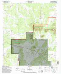
1995 Map of Red Flats
USGS Topo · Published 1998About this map
The Continental Divide winds through this high-altitude landscape of Catron County, marking the crest between the Sawtooth Mountains and the expansive Red Flats. Much of the territory falls within the Cibola National Forest, where topography is defined by dramatic geological features like Capital Dome, Lone Mountain, and the Airplane Hills. This survey, updated in the mid-1990s, captures a region shaped by ranching and transit across the arid West.
Find a feature on this map
52 named features on this map. Tap any name to fly to it.
Don’t see what you’re looking for? This feature index may not catch every label — zoom into the map to look around manually.
Map Details
Editions of this 1995 Red Flats Map
This is the sole edition of this map. No revisions or reprints were ever made.
Other maps of this area

1954 · Saint Johns
USGS Topo · 1:250,000

1954 · Socorro
USGS Topo · 1:250,000

1957 · Saint Johns
USGS Topo · 1:250,000

1958 · Socorro
USGS Topo · 1:250,000

1958 · Saint Johns
USGS Topo · 1:250,000

1962 · Socorro
USGS Topo · 1:250,000

1962 · Saint Johns
USGS Topo · 1:250,000

1964 · Third Canyon
USGS Topo · 1:24,000
1964 · Madre Mountain
USGS Topo · 1:24,000

1964 · Crosby Springs
USGS Topo · 1:24,000