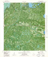
1982 Map of Red Head
USGS Topo · Published 1983About this map
The Choctawhatchee River forms the western boundary of this landscape, where the edges of Walton, Washington, and Bay counties meet in a complex network of wetlands and pine woods. Within the Pine Log State Forest, the terrain is defined by low-lying drainages like Pine Log Creek and Botheration Creek, interspersed with numerous named water bodies including Court Martial Lake and Tiller Mill Lake. The small settlement of Red Head is a focal point for local history, situated near the Woody Lookout Tower and a Landing Strip. Local religious and community life is anchored by Oak Grove Ch, which stands near a small Graveyard. This orthophotomap, based on 1976 aerial photography, reveals the industrial and recreational footprint of the early 1980s through features like a Claypit and several jeep trails cutting through the forest.
Find a feature on this map
28 named features on this map. Tap any name to fly to it.
Don’t see what you’re looking for? This feature index may not catch every label — zoom into the map to look around manually.
Map Details
Editions of this 1982 Red Head Map
This is the sole edition of this map. No revisions or reprints were ever made.
Other maps of this area

1943 · Seminole Hills
USGS Topo · 1:24,000

1943 · West Bay
USGS Topo · 1:24,000

1943 · Southport
USGS Topo · 1:24,000

1944 · Southport
USGS Topo · 1:24,000

1944 · Seminole Hills
USGS Topo · 1:31,680

1944 · West Bay
USGS Topo · 1:31,680

1944 · Crystal Lake
USGS Topo · 1:24,000

1944 · Bruce
USGS Topo · 1:24,000

1945 · Red Head
USGS Topo · 1:31,680

1945 · Bruce
USGS Topo · 1:31,680