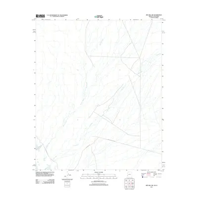
2011 Map of Red Hill SW
USGS Topo · Published 2011About this map
Yuma Proving Ground occupies the southern portion of this desert landscape, where the administrative boundaries of the military installation intersect with a network of desert washes and unpaved access roads. The hydrology is dominated by ephemeral systems including McAllister Wash and Indian Wash, which drain the arid terrain from the northwest to the southeast. Transportation through this remote section of Imperial County relies on a series of rudimentary routes, most notably Palo Verde Point Rd, Red Cloud Rd, and Indian Wash Rd. These roads provide the primary points of reference for navigating the alluvial fans and drainage patterns that characterize the area's geography during the early twenty-first century.
Find a feature on this map
6 named features on this map. Tap any name to fly to it.
Don’t see what you’re looking for? This feature index may not catch every label — zoom into the map to look around manually.
Map Details
Editions of this 2011 Red Hill SW Map
This is the sole edition of this map. No revisions or reprints were ever made.
Other maps of this area

1903 · Yuma
USGS Topo · 1:125,000

1905 · Yuma
USGS Topo · 1:125,000

1929 · Laguna
USGS Topo · 1:62,500

1939 · Red Hill
USGS Topo · 1:62,500

1942 · Yuma
USGS Topo · 1:250,000

1942 · Blythe
USGS Topo · 1:250,000

1943 · Laguna
USGS Topo · 1:62,500

1945 · Picacho Peak
USGS Topo · 1:62,500

1945 · Picacho
USGS Topo · 1:62,500

1951 · Picacho
USGS Topo · 1:62,500