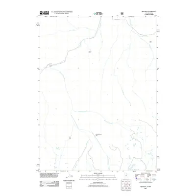
2011 Map of Red Hole
USGS Topo · Published 2011About this map
Chalk Creek and its complex system of tributaries carve through the high terrain of Summit County in this early 21st-century study. The landscape is defined by its drainage network, with the East Fork and Middle Fork converging as they move through the quadrangle. Human presence is sparse and largely concentrated at the northern end of the map, where Chalk Creek Rd provides access to scattered outposts like Rigby Ranch, Aagard Ranch, and the Pine Cliff Camp. In the southern reaches, the geography becomes more secluded, featuring the topographic depression known as Red Hole and small upland water bodies including Joyce Lake and Boyer Lake. The inclusion of the Beaver Meadow Dam reflects the ongoing management of water resources in these high-altitude ranching and wilderness areas.
Find a feature on this map
12 named features on this map. Tap any name to fly to it.
Don’t see what you’re looking for? This feature index may not catch every label — zoom into the map to look around manually.
Map Details
Editions of this 2011 Red Hole Map
This is the sole edition of this map. No revisions or reprints were ever made.
Other maps of this area

1885 · Salt Lake
USGS Topo · 1:250,000

1885 · Uinta
USGS Topo · 1:250,000

1900 · Coalville
USGS Topo · 1:125,000

1901 · Hayden Peak
USGS Topo · 1:125,000

1903 · Hayden Peak
USGS Topo · 1:125,000

1903 · Coalville
USGS Topo · 1:125,000

1954 · Salt Lake City
USGS Topo · 1:250,000

1954 · Ogden
USGS Topo · 1:250,000

1958 · Ogden
USGS Topo · 1:250,000

1958 · Salt Lake City
USGS Topo · 1:250,000