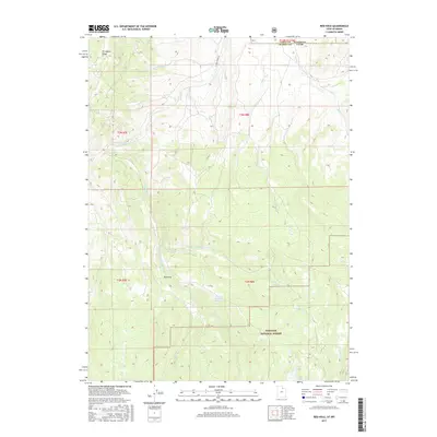
2017 Map of Red Hole
USGS Topo · Published 2017About this map
Chalk Cr and its complex network of tributaries define this high-country landscape along the border of Utah and Wyoming. The map captures a transition from the drainage basins of the E Fork Chalk Cr to the protected woodlands of the Wasatch National Forest. Notable water management and natural catchments appear throughout the terrain, including Beaver Meadow Reservoir and the more remote Joyce Lake and Boyer Lake to the south. The area around Red Hole shows the intersection of several drainages like Mill Fork and the Middle Fork E Fork Chalk Cr. This 2017 survey reflects the area's continued use for watershed protection and forestry, with E Chalk Creek Rd providing the primary access point into the interior of these mountain drainages.
Find a feature on this map
17 named features on this map. Tap any name to fly to it.
Don’t see what you’re looking for? This feature index may not catch every label — zoom into the map to look around manually.
Map Details
Editions of this 2017 Red Hole Map
This is the sole edition of this map. No revisions or reprints were ever made.
Other maps of this area

1885 · Salt Lake
USGS Topo · 1:250,000

1885 · Uinta
USGS Topo · 1:250,000

1900 · Coalville
USGS Topo · 1:125,000

1901 · Hayden Peak
USGS Topo · 1:125,000

1903 · Hayden Peak
USGS Topo · 1:125,000

1903 · Coalville
USGS Topo · 1:125,000

1954 · Salt Lake City
USGS Topo · 1:250,000

1954 · Ogden
USGS Topo · 1:250,000

1958 · Ogden
USGS Topo · 1:250,000

1958 · Salt Lake City
USGS Topo · 1:250,000