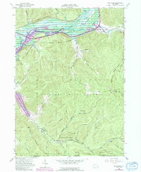
1962 Map of Red House
USGS Topo · Published 1991About this map
Allegheny River Reservoir dominates the northern valley of this 1962 landscape, reflecting a period of significant geographical change as controlled inundation transformed the Allegheny River corridor. The map documents the overlap of the Allegheny Indian Reservation and Allegany State Park, showing a mix of established settlements like Red House and Cold Spring alongside recreational and social landmarks. Notable sites include the Red House Chapel, St Johns Ch, and the high-altitude Ski Jumps near the eastern boundary. To the south, the Quaker Run Area is defined by specialized camps such as Camp Turner and Camp No 5, tucked into the folds of the mountains near Science Lake. The presence of an Old Railroad Grade and Conrail tracks alongside river features like Sunfish Cove and Witchs Walk illustrates the area's transition from early industrial transit to a managed natural landscape.
Find a feature on this map
65 named features on this map. Tap any name to fly to it.
Don’t see what you’re looking for? This feature index may not catch every label — zoom into the map to look around manually.
Map Details
Editions of this 1962 Red House Map
4 editions found
Other maps of this area

1900 · Salamanca
USGS Topo · 1:62,500

1922 · Randolph
USGS Topo · 1:62,500

1923 · Randolph
USGS Topo · 1:62,500

1924 · Bradford
USGS Topo · 1:62,500

1926 · Bradford
USGS Topo · 1:62,500

1936 · Kinzua
USGS Topo · 1:48,000

1938 · Salamanca
USGS Topo · 1:62,500

1941 · Kinzua
USGS Topo · 1:62,500

1941 · Bradford
USGS Topo · 1:62,500

1943 · Randolph
USGS Topo · 1:62,500