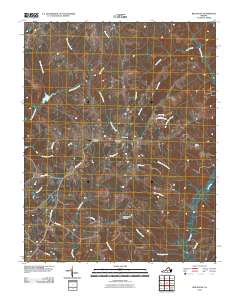
2010 Map of Red House
USGS Topo · Published 2010About this map
Red House serves as the central hub of this Charlotte County landscape, where the Red House Post Office and Redhouse Airfield anchor the local infrastructure. The terrain is defined by a dense network of tributaries, including Little Falling River, Turnip Creek, and Marrowbone Creek, which have shaped the agricultural and transport patterns of the region for generations. Rural life is evidenced by the presence of Whites Chapel Cemetery and small communities like Rolling Hill. The map detail captures the intersection of state routes and private lanes such as St John Ln and Marston Farm Ln, reflecting a community where family-named landholdings and farm-to-market roads persist. Numerous watercourses like Madison Mill Branch and Tanyard Branch hint at the historical reliance on local water power and drainage for the area's development.
Find a feature on this map
32 named features on this map. Tap any name to fly to it.
Don’t see what you’re looking for? This feature index may not catch every label — zoom into the map to look around manually.
Map Details
Editions of this 2010 Red House Map
This is the sole edition of this map. No revisions or reprints were ever made.
Other maps of this area

1892 · Appomattox
USGS Topo · 1:125,000

1947 · Roanoke
USGS Topo · 1:250,000

1956 · Brookneal
USGS Topo · 1:62,500

1956 · Charlotte Court House
USGS Topo · 1:62,500

1958 · Appomattox
USGS Topo · 1:62,500

1958 · Pamplin City
USGS Topo · 1:62,500

1959 · Roanoke
USGS Topo · 1:250,000

1963 · Roanoke
USGS Topo · 1:250,000
1966 · Mike
USGS Topo · 1:24,000
1966 · Brookneal
USGS Topo · 1:24,000