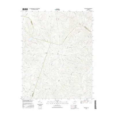
2016 Map of Red House
USGS Topo · Published 2016About this map
Red House serves as the central hub for this rural Virginia landscape, situated where Charlotte, Appomattox, and Campbell counties converge. The terrain is defined by a dense network of minor waterways, including Little Falling River and Turnip Cr, which carve through the countryside and historically dictated the placement of roads and farmstead boundaries. The area maintains a predominantly agricultural character, evidenced by the scattered network of rural routes like Hat Creek Rd and Red House Rd.
Find a feature on this map
72 named features on this map. Tap any name to fly to it.
Don’t see what you’re looking for? This feature index may not catch every label — zoom into the map to look around manually.
Map Details
Editions of this 2016 Red House Map
This is the sole edition of this map. No revisions or reprints were ever made.
Other maps of this area

1892 · Appomattox
USGS Topo · 1:125,000

1947 · Roanoke
USGS Topo · 1:250,000

1956 · Brookneal
USGS Topo · 1:62,500

1956 · Charlotte Court House
USGS Topo · 1:62,500

1958 · Appomattox
USGS Topo · 1:62,500

1958 · Pamplin City
USGS Topo · 1:62,500

1959 · Roanoke
USGS Topo · 1:250,000

1963 · Roanoke
USGS Topo · 1:250,000
1966 · Mike
USGS Topo · 1:24,000
1966 · Brookneal
USGS Topo · 1:24,000