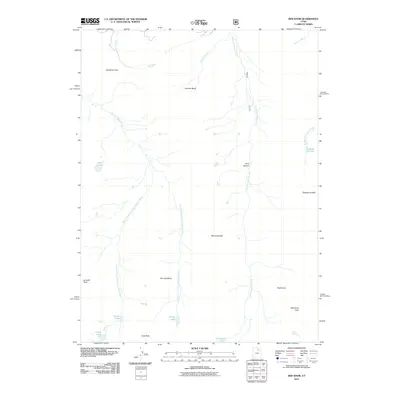
2011 Map of Red Knob
USGS Topo · Published 2011About this map
Tokewanna Peak and Mount Beulah anchor this high-elevation landscape in the Uinta Mountains, where the drainage systems of the East Fork Bear River and West Fork Blacks Fork originate. The topography is defined by glaciated basins and sharp ridges, most notably The Cathedral and Red Knob, which separates the surrounding watersheds. High alpine lakes are concentrated in the western and southern reaches of the map, including Lake Lorena, Norice Lake, and Priord Lake near Yard Peak. This area, managed as part of the National Forest system, shows a landscape almost entirely devoid of permanent human settlements, instead emphasizing the natural hydrology and topographical landmarks used by hikers and surveyors. Notable crossings such as Deadman Pass and Red Knob Pass provide the primary navigational points through this vertical terrain.
Find a feature on this map
24 named features on this map. Tap any name to fly to it.
Don’t see what you’re looking for? This feature index may not catch every label — zoom into the map to look around manually.
Map Details
Editions of this 2011 Red Knob Map
This is the sole edition of this map. No revisions or reprints were ever made.
Other maps of this area

1885 · Uinta
USGS Topo · 1:250,000

1901 · Hayden Peak
USGS Topo · 1:125,000

1903 · Hayden Peak
USGS Topo · 1:125,000

1954 · Salt Lake City
USGS Topo · 1:250,000

1958 · Salt Lake City
USGS Topo · 1:250,000

1960 · Salt Lake City
USGS Topo · 1:250,000

1967 · Explorer Peak
USGS Topo · 1:24,000
1967 · Mount Lovenia
USGS Topo · 1:24,000
1967 · Elizabeth Mtn
USGS Topo · 1:24,000
1967 · Oweep Creek
USGS Topo · 1:24,000