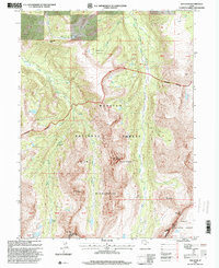
1996 Map of Red Knob
USGS Topo · Published 2000About this map
The High Uintas, as documented in this mid-1990s revision, reveal a landscape defined by dramatic alpine summits and glacial basins. Rising along the Summit-Duchesne County line, the prominent Red Knob and its namesake Red Knob Pass serve as key markers in this wilderness. The terrain is characterized by steep ridges and isolated water bodies, including Lake Lorena, Norice Lake, and Allison Lake, which feed the drainage systems of the Bear River and the West Fork Blacks Fork.
Find a feature on this map
25 named features on this map. Tap any name to fly to it.
Don’t see what you’re looking for? This feature index may not catch every label — zoom into the map to look around manually.
Map Details
Editions of this 1996 Red Knob Map
This is the sole edition of this map. No revisions or reprints were ever made.
Other maps of this area

1885 · Uinta
USGS Topo · 1:250,000

1901 · Hayden Peak
USGS Topo · 1:125,000

1903 · Hayden Peak
USGS Topo · 1:125,000

1954 · Salt Lake City
USGS Topo · 1:250,000

1958 · Salt Lake City
USGS Topo · 1:250,000

1960 · Salt Lake City
USGS Topo · 1:250,000

1967 · Explorer Peak
USGS Topo · 1:24,000
1967 · Mount Lovenia
USGS Topo · 1:24,000
1967 · Elizabeth Mtn
USGS Topo · 1:24,000
1967 · Oweep Creek
USGS Topo · 1:24,000