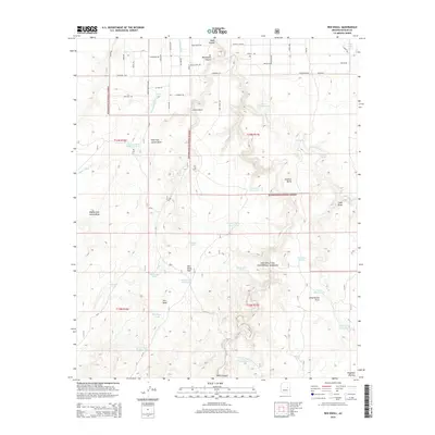
2014 Map of Red Knoll
USGS Topo · Published 2014About this map
Sitgreaves National Forest encompasses the drainage networks and high mesas of this 2014 survey on the Mogollon Plateau. The landscape is defined by its deep, winding watercourses including Black Canyon, Brookbank Canyon, and the extensive Larson Draw system. This area reflects a reliance on managed water sources for ranching or forestry, as evidenced by the high density of named tanks and catchments like Stolen Tank Number Two, Ancient Tank, and the Cement Dam Tank. Notable landmarks such as Solomon Butte and the eponymous Red Knoll provide distinct elevation points above the surrounding flats. A network of rural routes, including Pinyon Rd and Rockwell Rd, connects these remote points of interest through the arid high-country terrain.
Find a feature on this map
66 named features on this map. Tap any name to fly to it.
Don’t see what you’re looking for? This feature index may not catch every label — zoom into the map to look around manually.
Map Details
Editions of this 2014 Red Knoll Map
This is the sole edition of this map. No revisions or reprints were ever made.
Other maps of this area

1886 · Holbrook
USGS Topo · 1:250,000

1893 · Holbrook
USGS Topo · 1:250,000

1954 · Holbrook
USGS Topo · 1:250,000

1957 · Holbrook
USGS Topo · 1:250,000

1958 · Holbrook
USGS Topo · 1:250,000

1960 · Holbrook
USGS Topo · 1:250,000

1961 · Clay Springs
USGS Topo · 1:62,500

1961 · Heber
USGS Topo · 1:62,500

1970 · Red Knoll
USGS Topo · 1:24,000
1971 · Zeniff
USGS Topo · 1:24,000