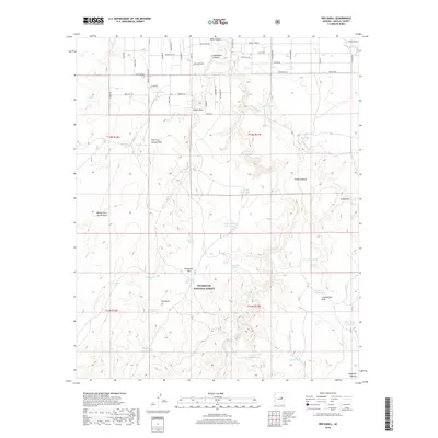
2018 Map of Red Knoll
USGS Topo · Published 2018About this map
Sitgreaves National Forest covers much of this high-altitude landscape in Navajo County, where a network of dry washes and named livestock tanks supports the region's ranching heritage. The terrain is defined by dramatic elevations, from the broad Red Knoll Flat to the prominent Solomon Butte. A complex system of draws, including Larson Draw and its various forks, channels seasonal water through the territory toward Black Canyon and Brookbank Canyon. The map reveals a high concentration of water management features essential for this arid environment, ranging from the historic-sounding Ancient Tank to Uranium Tank and Gardner Tank. To the south, the land rises toward the edge of the Mogollon Plateau, while the northern portion is marked by a grid of rural residential roads near Johns Corner, with names like Celeste Camino and Deeazinon Rd hinting at local settlement patterns.
Find a feature on this map
72 named features on this map. Tap any name to fly to it.
Don’t see what you’re looking for? This feature index may not catch every label — zoom into the map to look around manually.
Map Details
Editions of this 2018 Red Knoll Map
This is the sole edition of this map. No revisions or reprints were ever made.
Other maps of this area

1886 · Holbrook
USGS Topo · 1:250,000

1893 · Holbrook
USGS Topo · 1:250,000

1954 · Holbrook
USGS Topo · 1:250,000

1957 · Holbrook
USGS Topo · 1:250,000

1958 · Holbrook
USGS Topo · 1:250,000

1960 · Holbrook
USGS Topo · 1:250,000

1961 · Clay Springs
USGS Topo · 1:62,500

1961 · Heber
USGS Topo · 1:62,500

1970 · Red Knoll
USGS Topo · 1:24,000
1971 · Zeniff
USGS Topo · 1:24,000