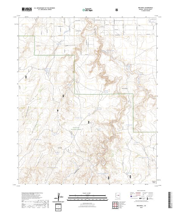
2023 Map of Red Knoll
USGS Topo · Published 2023About this map
Sitgreaves National Forest covers much of this high-altitude landscape on the Mogollon Plateau, where the terrain is deeply incised by drainages like Black Canyon and Brookbank Canyon. The map reveals an intricate network of water management features essential for ranching or forestry in this arid environment, including Uranium Tank, Ancient Tank, and Cement Dam Tank. These scattered reservoirs are often situated at the heads of significant draws such as Larson Draw and Long Hollow Draw.
Find a feature on this map
71 named features on this map. Tap any name to fly to it.
Don’t see what you’re looking for? This feature index may not catch every label — zoom into the map to look around manually.
Map Details
Editions of this 2023 Red Knoll Map
This is the sole edition of this map. No revisions or reprints were ever made.
Other maps of this area

1886 · Holbrook
USGS Topo · 1:250,000

1893 · Holbrook
USGS Topo · 1:250,000

1954 · Holbrook
USGS Topo · 1:250,000

1957 · Holbrook
USGS Topo · 1:250,000

1958 · Holbrook
USGS Topo · 1:250,000

1960 · Holbrook
USGS Topo · 1:250,000

1961 · Clay Springs
USGS Topo · 1:62,500

1961 · Heber
USGS Topo · 1:62,500

1970 · Red Knoll
USGS Topo · 1:24,000
1971 · Zeniff
USGS Topo · 1:24,000