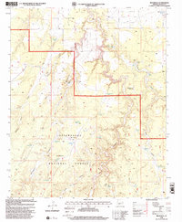
1998 Map of Red Knoll
USGS Topo · Published 2000About this map
Sitgreaves National Forest defines the rugged high-country character of this Navajo County landscape, where the terrain is carved by a complex network of canyons and draws. The prominent Solomon Butte and the eponymous Red Knoll rise above a high plateau, providing natural landmarks for this arid region. The drainage system is particularly distinct, featuring the Middle Fork, East Fork, and Larson Draw itself, which eventually give way to deeper incisions like Black Canyon and Brookbank Canyon.
Find a feature on this map
35 named features on this map. Tap any name to fly to it.
Don’t see what you’re looking for? This feature index may not catch every label — zoom into the map to look around manually.
Map Details
Editions of this 1998 Red Knoll Map
This is the sole edition of this map. No revisions or reprints were ever made.
Other maps of this area

1886 · Holbrook
USGS Topo · 1:250,000

1893 · Holbrook
USGS Topo · 1:250,000

1954 · Holbrook
USGS Topo · 1:250,000

1957 · Holbrook
USGS Topo · 1:250,000

1958 · Holbrook
USGS Topo · 1:250,000

1960 · Holbrook
USGS Topo · 1:250,000

1961 · Clay Springs
USGS Topo · 1:62,500

1961 · Heber
USGS Topo · 1:62,500

1970 · Red Knoll
USGS Topo · 1:24,000
1971 · Zeniff
USGS Topo · 1:24,000