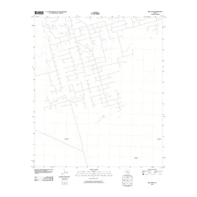
2010 Map of Red Lakes
USGS Topo · Published 2010About this map
Red Lakes sits at the center of this 2010 survey of West Texas, surrounded by an extensive network of industrial access roads and ranch infrastructure. The terrain is defined by its water management and resource extraction history, evidenced by family-named or numbered landmarks such as the Number One Windmill and the Number Two Windmill. Further south, the Steel Rim Windmill points to the continued reliance on these specific points of infrastructure in the arid Ector County landscape. The road pattern suggests a high density of oil and gas activity or large-scale ranching operations, where named windmills served as critical geographic markers for travelers and workers across the plains.
Find a feature on this map
4 named features on this map. Tap any name to fly to it.
Don’t see what you’re looking for? This feature index may not catch every label — zoom into the map to look around manually.
Map Details
Editions of this 2010 Red Lakes Map
This is the sole edition of this map. No revisions or reprints were ever made.
Other maps of this area

1954 · Pecos
USGS Topo · 1:250,000

1957 · Pecos
USGS Topo · 1:250,000

1964 · Turnbaugh Corner
USGS Topo · 1:24,000

1964 · Douro
USGS Topo · 1:24,000

1964 · Metz
USGS Topo · 1:24,000

1964 · Red Lakes
USGS Topo · 1:24,000

1964 · Penwell
USGS Topo · 1:24,000

1965 · Goldsmith
USGS Topo · 1:24,000

1968 · Cowden Place
USGS Topo · 1:24,000

1971 · Notrees
USGS Topo · 1:24,000