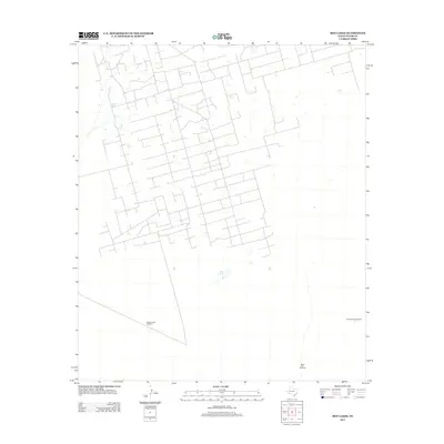
2012 Map of Red Lakes
USGS Topo · Published 2012About this map
Red Lakes and Claypit Tank anchor the central and northern reaches of this arid Ector County landscape, serving as vital water points for the livestock operations that define the region. The map reveals an intricate, grid-like network of secondary roads and tracks, illustrating the systematic access required for resource management in West Texas. Scattered landmarks like Number One Windmill, Number Two Windmill, and the Steel Rim Windmill highlight the reliance on groundwater for ranching. This 2012 survey by the U.S. Geological Survey captures a landscape where industry and agriculture share a sparse, functional infrastructure, and modern data layers are integrated to show precise road alignments and hydrological features.
Find a feature on this map
5 named features on this map. Tap any name to fly to it.
Don’t see what you’re looking for? This feature index may not catch every label — zoom into the map to look around manually.
Map Details
Editions of this 2012 Red Lakes Map
This is the sole edition of this map. No revisions or reprints were ever made.
Other maps of this area

1954 · Pecos
USGS Topo · 1:250,000

1957 · Pecos
USGS Topo · 1:250,000

1964 · Turnbaugh Corner
USGS Topo · 1:24,000

1964 · Douro
USGS Topo · 1:24,000

1964 · Metz
USGS Topo · 1:24,000

1964 · Red Lakes
USGS Topo · 1:24,000

1964 · Penwell
USGS Topo · 1:24,000

1965 · Goldsmith
USGS Topo · 1:24,000

1968 · Cowden Place
USGS Topo · 1:24,000

1971 · Notrees
USGS Topo · 1:24,000