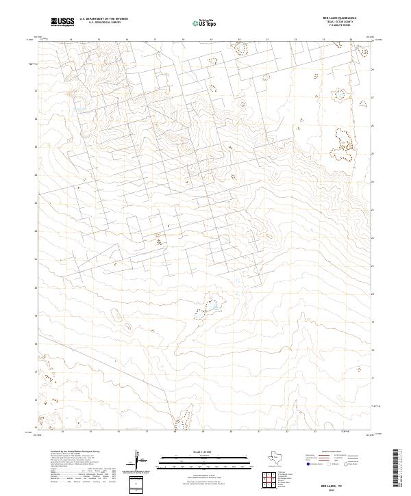
2022 Map of Red Lakes
USGS Topo · Published 2022About this map
The arid landscape of the West Texas Permian Basin is defined by subtle depressions and water management features on this contemporary survey. Red Lakes, located in the central portion of the quadrangle, represents a critical hydrologic landmark in an otherwise dry terrain. To the northwest, Claypit Tank serves as another focal point for water catchment, reflecting the region's reliance on engineered tanks for livestock or industrial use. The map reveals an extensive, geometric grid of access roads and section lines typical of the Ector County oil fields, where the landscape is intricately partitioned for mineral extraction and ranching. The topographic relief is gentle, punctuated only by these isolated catchments and the sparse infrastructure of the high plains.
Find a feature on this map
3 named features on this map. Tap any name to fly to it.
Don’t see what you’re looking for? This feature index may not catch every label — zoom into the map to look around manually.
Map Details
Editions of this 2022 Red Lakes Map
This is the sole edition of this map. No revisions or reprints were ever made.
Other maps of this area

1954 · Pecos
USGS Topo · 1:250,000

1957 · Pecos
USGS Topo · 1:250,000

1964 · Turnbaugh Corner
USGS Topo · 1:24,000

1964 · Douro
USGS Topo · 1:24,000

1964 · Metz
USGS Topo · 1:24,000

1964 · Red Lakes
USGS Topo · 1:24,000

1964 · Penwell
USGS Topo · 1:24,000

1965 · Goldsmith
USGS Topo · 1:24,000

1968 · Cowden Place
USGS Topo · 1:24,000

1971 · Notrees
USGS Topo · 1:24,000