
1964 Map of Red Lakes
USGS Topo · Published 1967About this map
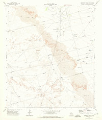
Industrial energy production and sparse desert resources define this mid-century West Texas landscape in Ector County. The terrain is dominated by the T X L Oil Field and the Lawson Oil Field, which are crisscrossed by an extensive network of pipelines and service roads. Within this petroleum-driven environment, water management is essential for both industry and ranching, as evidenced by features like Red Lakes, King Lake, and catchment points such as Claypit Tank and Red Tank. Scattered windmills, including the Number Two Windmill and Steel Rim Windmill, provide critical water access across the dry flats. Small-scale resource extraction is also visible at several Gravel Pit sites, while the proximity to Goldsmith indicates the region's connection to the broader Permian Basin economy. The map provides a detailed view of these infrastructure patterns before later decades of intensified expansion.
Find a feature on this map
12 named features on this map. Tap any name to fly to it.
Don’t see what you’re looking for? This feature index may not catch every label — zoom into the map to look around manually.
Map Details
Editions of this 1964 Red Lakes Map
This is the sole edition of this map. No revisions or reprints were ever made.
Other maps of this area

1954 · Pecos
USGS Topo · 1:250,000

1957 · Pecos
USGS Topo · 1:250,000

1964 · Turnbaugh Corner
USGS Topo · 1:24,000

1964 · Douro
USGS Topo · 1:24,000

1964 · Metz
USGS Topo · 1:24,000

1964 · Penwell
USGS Topo · 1:24,000

1965 · Goldsmith
USGS Topo · 1:24,000

1968 · Cowden Place
USGS Topo · 1:24,000

1971 · Notrees
USGS Topo · 1:24,000
1971 · Amburgey Ranch
USGS Topo · 1:24,000