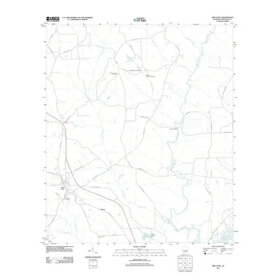
2011 Map of Red Level
USGS Topo · Published 2011About this map
The town of Red Level anchors the southwestern portion of this Covington County landscape, where the local road network converges near Fairmount Cemetery. The terrain is defined by the winding course of Patsaliga Creek, which flows southward through a series of crossing points like Barnes Bridge before reaching the larger waters of the Conecuh River Point A Lake at the bottom edge of the survey. North of the town, the rural character is punctuated by Rhump and small-scale water management features including the James Ingram Lake Dam and the W C Huggins Dam at Willow Wood Pond. This 2011 survey captures a mix of timberland and small agricultural plots intersected by numerous named creeks like Buck Creek and Turkey Creek, illustrating the drainage patterns that have shaped land use in this part of Alabama for generations.
Find a feature on this map
46 named features on this map. Tap any name to fly to it.
Don’t see what you’re looking for? This feature index may not catch every label — zoom into the map to look around manually.
Map Details
Editions of this 2011 Red Level Map
This is the sole edition of this map. No revisions or reprints were ever made.
Other maps of this area

1953 · Andalusia
USGS Topo · 1:250,000

1957 · Andalusia
USGS Topo · 1:250,000

1971 · Brooks
USGS Topo · 1:24,000

1971 · Industry
USGS Topo · 1:24,000

1971 · River Falls
USGS Topo · 1:24,000

1971 · Mc Kenzie
USGS Topo · 1:24,000

1971 · Andalusia
USGS Topo · 1:24,000

1971 · Gantt
USGS Topo · 1:24,000

1971 · Leon
USGS Topo · 1:24,000

1971 · Red Level
USGS Topo · 1:24,000