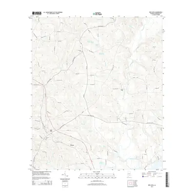
2014 Map of Red Level
USGS Topo · Published 2014About this map
Red Level and the nearby settlement of Rhump serve as the primary hubs in this section of Covington County, situated amidst a landscape defined by an intricate network of creeks and named ponds. Patsaliga Creek meanders through the eastern portion of the terrain, joined by tributaries such as Buck Cr and Turkey Cr. The distribution of water features like Nall Pond, Bryant Pond, and Ingram Pond suggests a history of local land management and resource use. Family names are deeply etched into the geography through road designations such as Boynin Rd, Huckabaa Rd, and Buster Merrill Rd. Genealogists may find value in the locations of Mt Carmel Cem and Fairmount Cem, which provide anchors for the community's ancestral history. The area is also marked by crossings such as Barnes Bridge and the path of Al-55, illustrating the region's connection to the broader Alabama transportation network.
Find a feature on this map
80 named features on this map. Tap any name to fly to it.
Don’t see what you’re looking for? This feature index may not catch every label — zoom into the map to look around manually.
Map Details
Editions of this 2014 Red Level Map
This is the sole edition of this map. No revisions or reprints were ever made.
Other maps of this area

1953 · Andalusia
USGS Topo · 1:250,000

1957 · Andalusia
USGS Topo · 1:250,000

1971 · Brooks
USGS Topo · 1:24,000

1971 · Industry
USGS Topo · 1:24,000

1971 · River Falls
USGS Topo · 1:24,000

1971 · Mc Kenzie
USGS Topo · 1:24,000

1971 · Andalusia
USGS Topo · 1:24,000

1971 · Gantt
USGS Topo · 1:24,000

1971 · Leon
USGS Topo · 1:24,000

1971 · Red Level
USGS Topo · 1:24,000