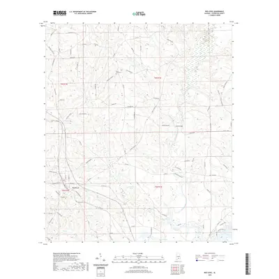
2020 Map of Red Level
USGS Topo · Published 2020About this map
Red Level stands at the center of this Covington County landscape, where the confluence of several significant watercourses defines the terrain. The Conecuh River flows through the southern reaches of the quadrangle, joined by the Patsaliga Creek and Gunter Mill Cr. The map reveals a network of rural roads named for local families and landmarks, such as Hesters Store Rd, Hazlet Bridge Rd, and Boykin Rd.
Find a feature on this map
90 named features on this map. Tap any name to fly to it.
Don’t see what you’re looking for? This feature index may not catch every label — zoom into the map to look around manually.
Map Details
Editions of this 2020 Red Level Map
This is the sole edition of this map. No revisions or reprints were ever made.
Other maps of this area

1953 · Andalusia
USGS Topo · 1:250,000

1957 · Andalusia
USGS Topo · 1:250,000

1971 · Brooks
USGS Topo · 1:24,000

1971 · Industry
USGS Topo · 1:24,000

1971 · River Falls
USGS Topo · 1:24,000

1971 · Mc Kenzie
USGS Topo · 1:24,000

1971 · Andalusia
USGS Topo · 1:24,000

1971 · Gantt
USGS Topo · 1:24,000

1971 · Leon
USGS Topo · 1:24,000

1971 · Red Level
USGS Topo · 1:24,000