Loading...
Loading map...1944 Map of Red Lodge
USGS Topo · Published 1946About this map
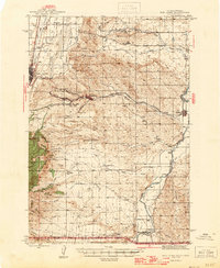
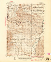
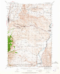
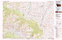
Red Lodge serves as the primary hub of this Montana-Wyoming borderland, where the coal industry and ranching culture intersect. The landscape is defined by its industrial activity, particularly east of the city where the Brophy Mine, Smith Mine, and Foster Mine are clustered near the settlements of Washoe and Bearcreek. These mining operations were serviced by the Northern Pacific railroad, which provided a vital link between the mineral-rich gulches and broader markets.
Find a feature on this map
43 named features on this map. Tap any name to fly to it.
Don’t see what you’re looking for? This feature index may not catch every label — zoom into the map to look around manually.
Map Details
Date Portrayed1944
Date Published1946
PublisherU.S. Geological Survey
Map TypeTopographic
Scale1:62,500
Physical Dimensions17 x 20.7 inches
Editions of this 1944 Red Lodge Map
3 editions found
Historical Maps of Red Lodge Through Time
Featured Locations
Source Details
SourceU.S. Geological Survey
CopyrightPublic Domain