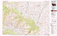
1989 Map of Red Lodge
USGS Topo · Published 1989About this map
Red Lodge serves as the focal point of this late-century survey, situated where the high plateaus of the Beartooth Mountains meet the plains. The landscape is defined by massive alpine features like the Hellroaring Plateau, Silver Run Plateau, and Granite Peak, which contrast with the agricultural and mining activity in the valleys to the east. The economic history of the area is visible through industrial sites such as the Brophy Mine and Foster Mine near Bearcreek, and the legacy of the Burlington Northern railroad lines.
Find a feature on this map
124 named features on this map. Tap any name to fly to it.
Don’t see what you’re looking for? This feature index may not catch every label — zoom into the map to look around manually.
Map Details
Editions of this 1989 Red Lodge Map
This is the sole edition of this map. No revisions or reprints were ever made.
Other maps of this area

1886 · Canyon
USGS Topo · 1:125,000

1891 · Livingston
USGS Topo · 1:250,000

1891 · Big Timber
USGS Topo · 1:125,000

1892 · Stillwater
USGS Topo · 1:125,000

1893 · Livingston
USGS Topo · 1:250,000

1893 · Big Timber
USGS Topo · 1:125,000

1895 · Canyon
USGS Topo · 1:125,000

1896 · Canyon
USGS Topo · 1:125,000

1896 · Crandall Creek
USGS Topo · 1:125,000

1898 · Granite Mountain District
USGS Topo · 1:125,000