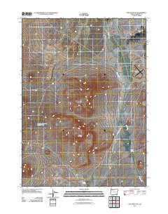
2011 Map of Red Mountain
USGS Topo · Published 2011About this map
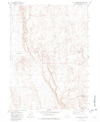
Red Mountain rises over the high desert landscape of Harney County, anchoring a terrain defined by seasonal water and remote ranching infrastructure. The drainage of Willow Creek dominates the eastern portion of the sheet, winding through the Whitehorse Valley and passing near the Whitehorse Ranch Airport. This corner of southeastern Oregon is shaped by its hydrology, where isolated sources like Warm Spring and Hot Spring provide critical water in an arid environment. Human modification of the landscape is evident in the presence of Buckskin Reservoir Number Four, designed to capture runoff for livestock in this wide-open country. Travel through the area is primarily facilitated by the Whitehorse Ranch Rd, which follows the natural contours of the basin between the mountain and the creek.
Find a feature on this map
8 named features on this map. Tap any name to fly to it.
Don’t see what you’re looking for? This feature index may not catch every label — zoom into the map to look around manually.
Map Details
Editions of this 2011 Red Mountain Map
This is the sole edition of this map. No revisions or reprints were ever made.
Other maps of this area

1955 · Adel
USGS Topo · 1:250,000

1957 · Adel
USGS Topo · 1:250,000

1958 · Adel
USGS Topo · 1:250,000

1962 · Adel
USGS Topo · 1:250,000

1981 · Tule Springs
USGS Topo · 1:24,000

1981 · Tule Springs NE
USGS Topo · 1:24,000
1981 · Little Whitehorse Creek
USGS Topo · 1:24,000
1981 · Red Mountain
USGS Topo · 1:24,000
1981 · Coyote Meadows
USGS Topo · 1:24,000
1981 · Red Lookout Butte
USGS Topo · 1:24,000